Paradigm CAD is drafting and civil CAD built for survey drawings: bearing-and-distance linework, COGO and deed traverses, survey points, TIN surfaces and contours, alignments and corridors, plotting to PDF, and DXF and DWG exchange.
Every save records a checkpoint in the project journal, and reopening after a crash or a forced exit restores the edits you made since. Separate recovery checkpoints are written every 10 minutes by default and hash-checked.
ftUS
US survey feet, kept straight
Distances, areas and acres read in the drawing's own unit, US survey feet stay distinct from international feet, and CAD warns you when the drawing header and its coordinate system disagree.
No silent loss
It never writes a partial file
When a format cannot hold part of a drawing, a strict export stops with a clear message instead of quietly dropping data. A lossy export asks first and lists every omission.
DWG in, DWG out
Open DWG drawings from AutoCAD 2000 through 2018 and save as DWG 2013, alongside ASCII DXF from R12 to 2018. Format checks read the file itself, not its extension.
COGO the way deeds are written
Inverse, sideshot, bearing and map check with curve legs, and a traverse ledger for entering deed calls in order.
Draft over the record
Attach a PDF plat as an underlay and snap to its linework while you draft.
In the app
Real screens, real data.
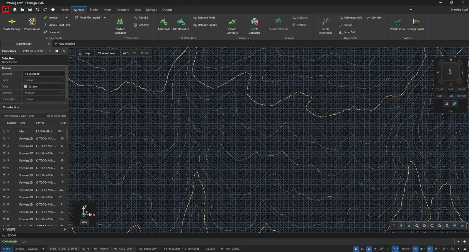
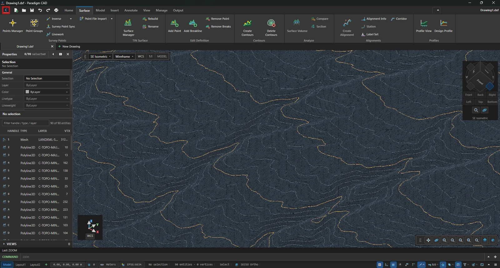
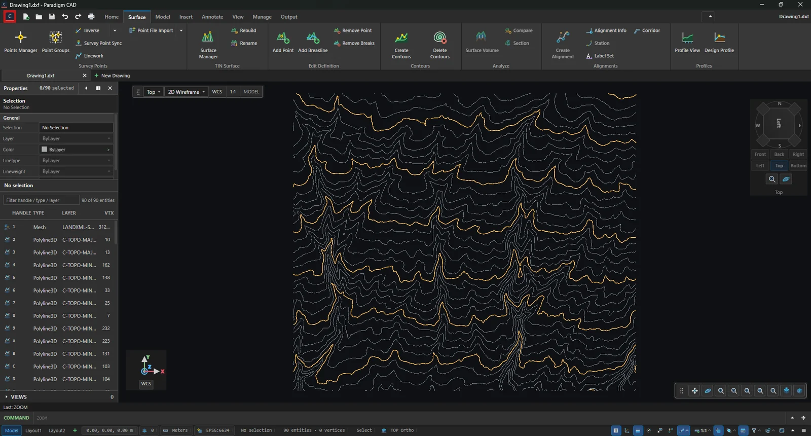
A surface built in Surveyor from USGS 3DEP lidar of Lāna'i, opened in CAD as LandXML (623,564 triangles on a 5 m grid), with contours made in CAD: 10 m minors and heavier 50 m majors.The same surface from the south-east. Each contour is a 3D polyline at its own elevation.All 89 contour polylines over the whole 3.0 × 2.6 km block, which rises from the shore to 353 m.
Overview
A drawing environment that speaks survey.
Lines go in by bearing and distance, deed calls go into a traverse ledger, and the drawing carries survey points, surfaces and sheets through to a plotted PDF.
Draft by bearing and distance
Lines by quadrant bearing and distance, tangent curves off a line end, snaps, ortho and polar tracking, and constraints.
COGO on the drawing
Inverse, sideshot, bearing and map check with curve legs, and a traverse ledger for deed calls.
Surfaces through to sheets
TIN surfaces with breaklines and contours, alignments, profiles and corridors, then layouts plotted and published to PDF.
Features
What CAD does.
Drafting
The commands a survey drawing needs
Window, crossing, lasso and fence selection; snaps, ortho and polar tracking with clickable command options; lines by quadrant bearing and distance and tangent curves off a line end.
Lines by bearing and distance
Blocks, attributes, dynamic blocks and xrefs
PDF underlays you can snap to
Measure and units
Readouts in the drawing's own unit
Distance and area report in the drawing's unit, including US survey feet, square survey feet and acres, and each drawing tab keeps its own undo history and view.
US survey feet distinct from international feet
A warning when the header and coordinate system disagree
COGO
Check the record as you draw it
Run an inverse or a sideshot, compute a bearing, map-check a boundary with its curve legs, and enter deed calls in a traverse ledger.
Inverse, sideshot and bearing
Map check with curve legs
Traverse ledger for deed calls
Survey points
Points, groups and coded linework
A point manager with point groups, description keys and point-file import and export, and coded points drawn as 3D linework.
Point groups and description keys
Point-file import and export
Linework from coded points
Surfaces and civil
Surfaces, alignments and corridors
Build a constrained TIN with breaklines and contours tied to it, run volume, compare and section reports, import LandXML surfaces as editable TINs, and lay out alignments, profiles and corridors.
TIN surfaces with breaklines and contours
Volume, compare and section reports
Alignments, profiles and corridors
Sheets and output
Layouts to plotted PDF
Set up layouts with CTB or STB plot styles, plot to PDF, and publish several drawings at once. 3D solids export to STEP and STL.
Layouts, plot styles and PDF plotting
Multi-drawing publish
3D solids with STEP and STL export
Safety
Your work, kept
Saves record checkpoints in the project journal and reopening restores later edits. Recovery checkpoints are hash-checked, and crash reports stay on your machine.
Journal restore after a crash
Recovery checkpoints every 10 minutes by default
Crash reports stay local
Specifications
Files and system requirements.
Opens
DWG 2000–2018
DXF R12–2018 (ASCII)
LandXML
OBJ
Saves and exports
DWG 2013
DXF R12–2018 (ASCII)
PDF
STEP
STL
System requirements
Component
Minimum
Operating system
Windows 10 or 11, 64-bit (Windows Server supported)
Graphics
A GPU with Vulkan 1.3 support
Runtime
Microsoft Edge WebView2 (part of Windows 11)
Questions
About CAD.
Does CAD open DWG files?
Yes. DWG drawings from AutoCAD 2000 to 2018 open within tested limits, and drawings save as DWG 2013. ASCII DXF from R12 to 2018 reads and writes.
What happens if CAD crashes?
Reopen the drawing. Every save records a checkpoint in the project journal, and CAD restores the edits you made after it.
Does CAD work with point clouds?
Point clouds belong in Surveyor. CAD picks up Surveyor's results as DXF linework and LandXML.
Can I plot sheets?
Yes. Layouts plot to PDF with CTB or STB plot styles, and several drawings can be published at once.
Get CAD
Draft, compute and plot in one place.
CAD is part of the launch release and is included in every Founders license.