
0+00Platform · File formats
Formats that keep the whole survey together.
Scans, projects, photos and linework each have a Paradigm format built for the way survey work changes. They open without reading everything, carry their coordinate system inside, and let you re-register or re-classify without converting again. Open standards come in and go out whenever the work moves on.
- Node index Octree in Morton order · 32 bytes a node · bounds and where each node's data sits
- Coordinate system WKT · horizontal and vertical EPSG · epoch · units · XXH64
- Point data, node by node XYZ · colour · intensity · class · normals · planarity · linearity · LZ4
Opening reads the header, the node index and the coordinate system. Point data loads node by node, for the part of the scan in view.
- Against its E57
- −41 %Same 317.7 M points, with more stored per point
- Storage step
- ≤ 1 mmFor 99.3 % of points; no point moves more than 1.8 mm
- In one file
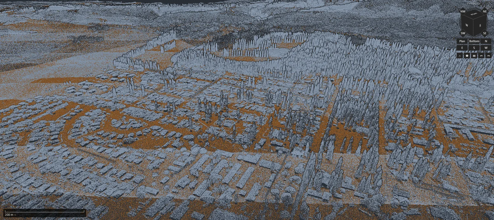
- 13.06billion pointsUSGS 3DEP lidar of Lāna'i, from 1,569 LAZ tiles
- Checked on open
- XXH64The header and the coordinate system
1+00.pgc2 · the scan
One scan. One file. Everything in it.
Convert a scan once and the .pgc2 that comes out is what you work from: Collector writes it in the field and Surveyor opens it in the office. It holds the points, everything measured or computed about them, and the coordinate system they're in.
-
Opens without reading it all
Opening reads the header and the node index, then loads point data piece by piece for the part of the scan in view. Scans larger than your graphics memory stream in as you move.
-
Everything travels together
Colour, intensity, classification, normals, planarity and linearity are stored for every point, with scan angle, user data and source IDs when you keep them. The coordinate system rides in the file: the full WKT, horizontal and vertical EPSG codes, the epoch, and units in metres, US survey feet or international feet.
-
Levels of detail built in
Each node of the octree holds a sampled copy of the points beneath it, so a distant view draws a fraction of the points. In the Runway scan those copies add 6.6 %.
-
Checked, and written safely
The header and the coordinate system carry XXH64 checksums that are verified every time the file opens. The converter writes to a temporary file, flushes it to disk and renames it into place, so an interrupted conversion never leaves a broken file where the finished one should be.
2+00Measured
Smaller than the E57 it came from.
Two Trimble X9 airfield scans, converted to .pgc2 with LZ4-HC compression. Each .pgc2 is about 40 % smaller than its E57 and 70 % smaller than LAS 1.2, and it carries normals, planarity, linearity and levels of detail that neither source has.
| Scan | Points | E57 | LAS 1.2 | .pgc2 | Against E57 |
|---|---|---|---|---|---|
| Runway | 317,660,485 | 5.38 GB | 10.80 GB | 3.16 GB | −41 % |
| Main area | 392,986,076 | 6.66 GB | 13.36 GB | 4.04 GB | −39 % |
The same points in every file. Each E57 holds one scan with intensity and colour and no images; the LAS files are point format 3. Decimal gigabytes, measured 17 October 2026. Against LAZ the result depends on what the .pgc2 carries: 13,060,946,265 points of USGS 3DEP lidar of Lāna'i take 164.3 GB as 1,569 LAZ tiles, 108.9 GB as one .pgc2 with position, intensity and classification, and 162.6 GB as one .pgc2 with normals added.
3+00Precision
Precision you can state.
Positions are stored relative to each node's box, on a grid that gets finer as the nodes get smaller. In the Runway scan, 99.3 % of points sit on a grid of 1 mm (0.0033 ft) or finer, the resolution of the LAS it came from. The coarsest grid anywhere in the file is 3.6 mm, so no point moves more than 1.8 mm.
Survey coordinates stay in double precision. The graphics card only ever sees small offsets from a local origin, and every export rebuilds each point in double precision from what is stored.
| Runway scan | Points |
|---|---|
| Stored on a 0.5 mm grid or finer | 95.7 % |
| Stored on a 1 mm (0.0033 ft) grid or finer | 99.34 % |
| Coarsest grid anywhere in the file | 3.6 mm |
| Largest move from the source position | 1.8 mm |
In the main-area scan, 98.65 % of points are stored on a 1 mm grid or finer.
4+00Registration and classification
Change the registration, not the points.
In a registration workspace every scan keeps its points in its own frame, and the registration lives in the scan poses. Registering again, adding scans or moving the job to a new frame edits the poses and the metadata. The points are never rewritten.
-
A new frame without a new conversion
Moving a 495-million-point, 6.23 GB workspace from metres into a project frame in US survey feet moved all 64 scan poses exactly, to nine decimal places of a foot. The point data stayed where it was and the file size didn't change.
-
Classify again, keep the scan
Classification is stored beside the scan in a .pgclass file fingerprinted to that exact dataset. Run it again without converting again; a classification made for a different dataset is refused.
5+00.pgsvy · the project
Projects that remember.
A Surveyor project is one .pgsvy file. Collector writes it in the field, Surveyor opens it as-is, and CAD can record its saves in the same project's journal.
-
Restore points that never destroy
Every restore point is stored by the SHA-256 of its content, and restoring an earlier one never deletes anything.
-
Proof of what you delivered
Every export you commit is logged in the project with its SHA-256 fingerprint (files over 2 GiB by size), so you can show exactly which file went to the client.
-
Pack & Go
The whole project packs into one ZIP64 file. When a moved project looks for its files again, it re-links each one only when it can prove it is the same file.
-
Back after a crash
When a project opens after a crash, interrupted operations are marked abandoned, stray files are set aside and completed work is replayed. How the jobs stay safe
6+00.pgci · photos
Photos that know where they were taken.
A .pgci packs a photo set with each photo's GPS position, heading, RTK precision and gimbal angles, plus a spatial index to find them. The original image bytes are kept exactly, HEIC photos from phones and drones open without installing a Windows codec, and each section of the file carries its own checksum.
6+50.pgcv · linework
Linework that keeps its true coordinates.
Vector layers in .pgcv keep full double-precision coordinates as the survey record. The simplified shapes drawn at a distance each record how far they depart from the true geometry. Surveyor opens and exports .pgcv.
7+00Open standards
In and out, app by app.
Paradigm formats are where the work lives; open standards are how it arrives and how it leaves. Each app reads and writes the formats below.
SurveyorPoint cloud production
- Brings in
- LAS
- LAZ
- E57
- PLY
- PTS
- PTX
- Trimble TDX / TZF
- RealWorks RWP
- CSV / TXT / PNT points
- Trimble FXL codes
- JPG / TIFF / HEIC photos
- DXF / DWG reference
- .pgc2
- .pgcv
- Delivers
- LAS 1.4
- LAZ
- E57
- .pgc2
- LandXML 1.2 TIN
- DXF linework & contours
- Shapefile
- CSV / TXT points
- GeoTIFF DEM
- GLB mesh
- KML / KMZ photos
- .pgcv
- Project archive (ZIP64)
CADSurvey drafting
- Opens
- DXF R12–2018
- DWG 2000–2018, within tested limits
- LandXML 1.0–2.0
- OBJ
- CSV / TXT points
- Saves and exports
- DXF R12–2018
- DWG 2013
- STEP
- STL
- CSV / TXT points
- eTransmit ZIP
PuckPlan sheets
- Opens
- Images
- DXF
- Exports
- DXF
- GeoJSON
- CSV
- PDF with searchable text
CollectorField scanning
- Runs
- Trimble X7 (R2.6.x)
- Writes
- .pgsvy project
- .pgc2 scans
- .pgci photos
- E57 per station
- JPEG panoramas
Pg-GPSGNSS post-processing
- Reads
- RINEX 2 and 3 observation and navigation
- NOAA CORS downloads
- Writes
- STAR*NET .dat
- Surveyor hand-off (PNEZD CSV, GeoJSON, DXF)
- Reports (Markdown, JSON, CSV)
Platform
The rest of the platform.
- PGC Core The engine One native engine under every app, measured on public data.
- Measured Speed 13 billion points of public lidar, timed in Surveyor.
- .pgc2 · .pgsvy · .pgci File formats Scans, projects and photos that keep the survey together.
- Background jobs Async Long jobs beside you, and projects that survive a crash.
- Command line Headless Conversion and GNSS processing without a window.